Tax Parcels with Gas Development Leases – cayugacountygasleasemap.jpg (JPEG Image, 2112×3264 pixels) – Scaled (26%)
September 27, 2011
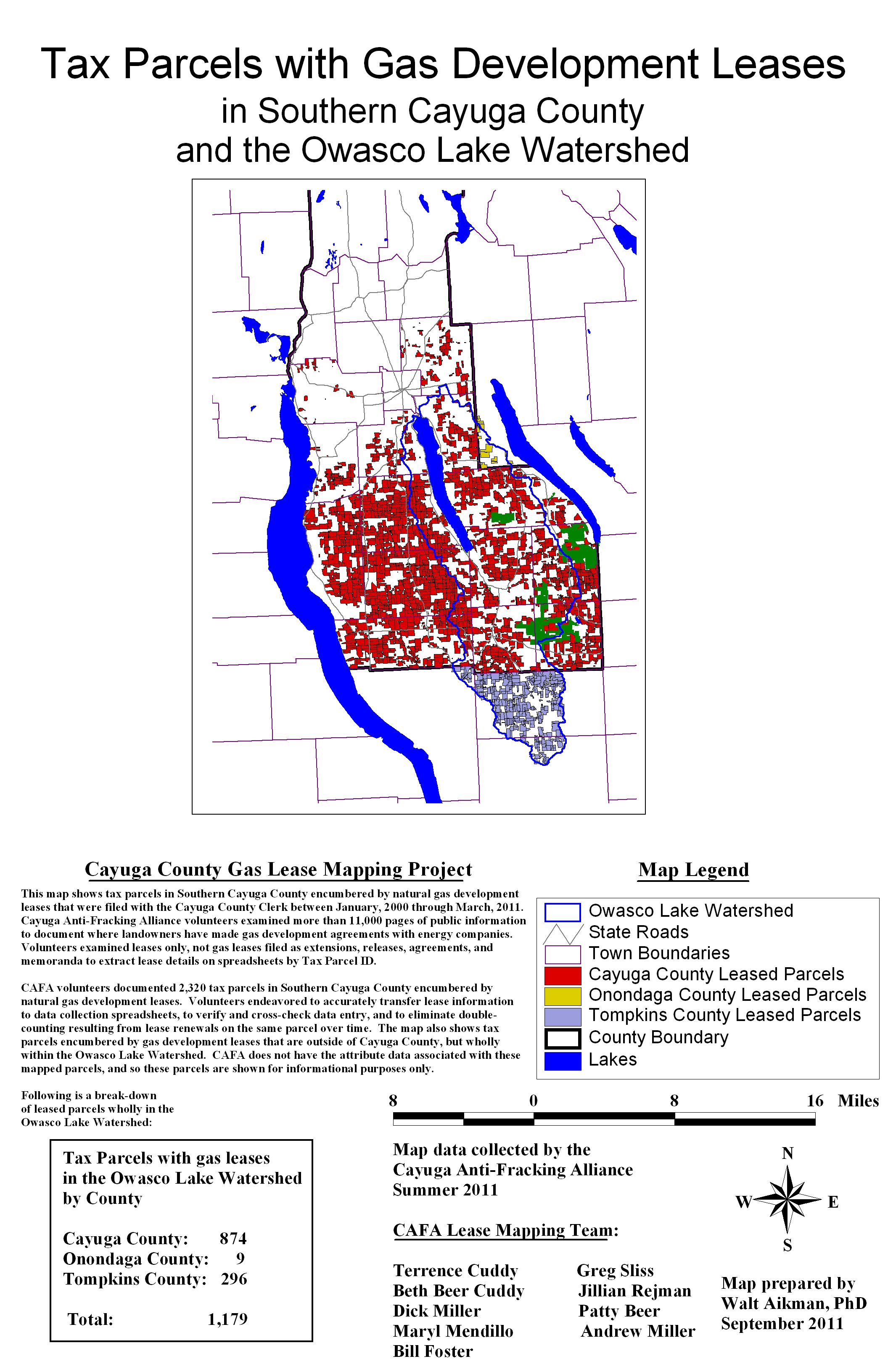
cayugacountygasleasemap.jpg (JPEG Image, 2112×3264 pixels) – Scaled (26%).
Gas Drilling Awareness for Cortland County
September 27, 2011
cayugacountygasleasemap.jpg (JPEG Image, 2112×3264 pixels) – Scaled (26%).
Filed under Leasing Issues, Maps
Filed under Maps, Spills-Accidents-Suits
Filed under Maps, Pipelines, Spills-Accidents-Suits Tagged with accidents/spills, gas drilling, gas industry, maps, natural gas, pipelines
April 26, 2011
Fraccidents Map | Marcellus Shale Protest. Earth Justice 4/11
Filed under Maps, Spills-Accidents-Suits
October 23, 2010 1 Comment
Cortland GAS LEASE PROPERTIES[1]
Large File
Cortland County gas lease properties map that Eric Lopez in the Planning Department and Terri Cinquanti in Real Property have been working diligently to put together. Just know that this map does lack identification of approximately 100 parcels which have 2010 tax map numbers that don’t match the 2009 tax map available for the overlay work (numbers change as properties are sub-divided, etc.) Terri spent a large amount of time correcting tax map numbers and updating the gas lease data set, the reason for the delay in creating this map.
The map does not include properties in landowner coalitions that will be leased when they are able to negotiate for acceptable terms.
TV Interviews with County Planner, Jim Weiss re the Cortland Lease Map
Filed under Cortland Data, Maps
